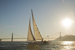
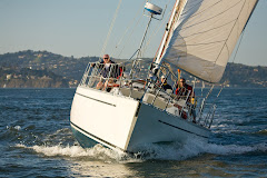
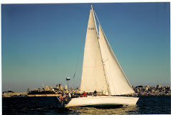
John and crew were officially in protected waters around 7pm Wed. That means they entered the Straits of Juan de Fuca. They tied up to a dock in Neah Bay, which is a small bay just around the corner from the entrance to the Straits. They had a dinner ashore and their first showers in 3 weeks. You can imagine how good that felt. And hopefully a good nights sleep. They were in cell phone range so I was finally able to talk to him and he sounded good.
Early Thursday morning they will get fuel and start the long day to Friday Harbor on San Juan Island where Anne and I will finally be able to hug our husbands again. Anne is Dick's wife, who is one of the crew for this leg.
Surprisingly, John likes the idea of he and I taking a few days to get to Bellingham and just cruise around and re-acquaint ourselves with our old/new cruising area. But he did make a promise that this was for fun and no boat projects. We'll see how that holds, but for now I'm just really happy that he's within a day of me seeing him again.
Thanks to everyone who followed their voyage and helped bring them safely home with their good thoughts and wishes.
Ciao, Gail
Thursday, September 6, 2012
Wednesday, September 5, 2012
Whales Galore
7:20AM HST
48 25.38N 125 54.41W
Next Waypoint: Cape Flattery
Range: 44NM
I measured about 20 Gal fuel in take so started motoring with 30NM to Cape Flattery & 10 more to Neah Bay, 40 total. Engine rpm = 2000; Speed at present = about 6kt with push from the swell even though there is no wind.
48 25.38N 125 54.41W
Next Waypoint: Cape Flattery
Range: 44NM
We just sailed through a huge pod of whales. We believe
humpbacks. One even came within a few feet of Music. A few feet!! We are still
spotting blows some distance off in front of us. But, what a greeting,
particularly after the winds and seas of last night.
So close, but the winds have gone light (8Kt and less)
and we must save our fuel. It would not due to run out just as we approach the
Straits.
10:00 (HST)
48 25.06N 125
33.00WI measured about 20 Gal fuel in take so started motoring with 30NM to Cape Flattery & 10 more to Neah Bay, 40 total. Engine rpm = 2000; Speed at present = about 6kt with push from the swell even though there is no wind.
Wish us luck & hope that we have at least 10-15 gal
of fuel.
Day 20 - Almost There
John and crew are almost to the Straits of Juan de Fuca, which is the long body of water that takes them into Puget Sound. They will get fuel in Neah Bay, which is right around the corner from entering the straits. Then after a good nights sleep at a dock, they will start to work their way to Bellingham - which is still 2 days away. But at least they will be in protected waters and will be able to stop for the night. Yeah - I can't wait to see them again. And Music of course, she has safely brought John home from Tahiti - almost 6,000 miles.
Time of position: 4AM (HST)
Lat/Lon: 48 25.00N 126 26.02W
Course: 068 deg Mag
Current Speed: 6kt
Wind: about 20Kt.
Next Waypoint: Str. Juan de Fuca
57NM distance
Date: 09/05
Noon to noon run: 159NM Time of position: 4AM (HST)
Lat/Lon: 48 25.00N 126 26.02W
Course: 068 deg Mag
Current Speed: 6kt
Wind: about 20Kt.
Next Waypoint: Str. Juan de Fuca
57NM distance
Just wanted to let you know that we are exiting the
compression zone of wind. Had lots of it from mid afternoon yesterday. Good
swell too. Really foggy this AM. Will switch clock to PDT, sometime today.
Maybe noon, or when we enter the Straits.
Monday, September 3, 2012
Day 19
Date: 09/03
Noon to noon run: 138NM
Time of position: 6PM (HST)
Lat/Lon: 48 20.20N 132 10.79W
Course: 073 deg Mag
Current Speed: 6.5kt
Next Waypoint: 48.00N; 135.00W
Range: 166
Bearing: 072m
Cheers, John
Noon to noon run: 138NM
Time of position: 6PM (HST)
Lat/Lon: 48 20.20N 132 10.79W
Course: 073 deg Mag
Current Speed: 6.5kt
Next Waypoint: 48.00N; 135.00W
Range: 166
Bearing: 072m
Synopsis The winds clocked aft in the early hours of the
morning and created some slow going for a while until I woke up about 6:30 to
7AM after coming off watch at 3AM, and we polled out the genoa. Then life got
better as the boat motion settled down and speed picked up. Late this afternoon
the wind has been filling in nicely.
At some point we will have to deal with another section
of strong winds created by the HI as it has reestablished itself and is sitting
close to the coast. This creates a compression effect, kind of like squeezing
the wind into a narrow slot. We see this along the California Coast every
summer and is partially why the northern California coast is called gale alley
among local sailors.
Well, it looks like we are going to get to deal with the
same thing closing on the coast up here. The good news is that we broke the
300NM mile mark just about noon today so we are closing in on Cape Flattery.
Now, if we can only get past the compression zone. Once again, wish us luck.
Cheers, John
Sunday, September 2, 2012
Day 18
A word of caution - the following commentary is not for the faint of heart :)
Time of position: 7PM (HST)
Lat/Lon: 47 59.670N 135 28.99W
Course: 060-065 deg Mag
Current Speed: about 6kt
Next Waypoint: 48.00N; 135.00W
140NM distance
Date: 09/02
Noon to noon run: 159NM Time of position: 7PM (HST)
Lat/Lon: 47 59.670N 135 28.99W
Course: 060-065 deg Mag
Current Speed: about 6kt
Next Waypoint: 48.00N; 135.00W
140NM distance
Synopsis
The breeze was light but steady all day allowing us to
make good progress. Cape Flattery, still over 400NM distant, is nevertheless
gowing closer.
Tropics v/s cold water sailing
My sweetheart, who is also my wife, does not much care
for the idea of cold water scuba diving. She says it is too much work, but I
can honestly tell you that there is not much difference between cold water
diving and cold water sailing. They both require a lot of work compared to
sailing or diving in the tropics. Think about it.
Sailing in cold water - getting dressed: underwear, long
underwear or at least polypropylene top,then pants, fleece shirt, vest, foul
weather bibs, coat, hat, PFD. To go pee: remove the PFD, remove hat (you're going
down below), remove the coat, unzip the foulie bibs and pull from shoulders,
pull pants down or risk peeing into them
inadvertently, move underwear aside or pull down. Tropics - to get dressed: put
on shorts and short sleeve shirt. To go pee, pull shorts aside and lean over
lifelines. Got it? (OK women have to do a bit more in the tropics, but at least
they are not sitting on a cold toilet seat.)
Cheers, John
Saturday, September 1, 2012
Day 17 1/2
Date: 09/01
Noon to noon run: 159NM
Time of position: 4PM (HST)
Lat/Lon: 47 25.46'N 139 32.34'W
Course: 060 deg Mag
Current Speed: 7kt
Next Waypoint: 48.00N; 135.00W
186NM distance
Noon to noon run: 159NM
Time of position: 4PM (HST)
Lat/Lon: 47 25.46'N 139 32.34'W
Course: 060 deg Mag
Current Speed: 7kt
Next Waypoint: 48.00N; 135.00W
186NM distance
Synopsis:
The low passed last night and all remained fine onboard
Music. The skies are still gray and temperature cold, but we are scooting right
along, the seas very raucous with some truly big rollers frequently coming
through from the northwest. The good news is that just after coming off watch
at 3pm I saw that we broke the 600 mile mark to Cape Flattery and we are less
than 200NM to our next waypoint at 135W.
Cheers, John
Day 17
Date: 09/01 05:00HST (we have not yet changed our clocks to PDT)
Lat/Lon: 47 09.00'N 141 13.65'W
Course: 054 deg Mag
Current Speed: 6-7kt
Next Waypoint: 48.00N; 135W
257NM distance
Lat/Lon: 47 09.00'N 141 13.65'W
Course: 054 deg Mag
Current Speed: 6-7kt
Next Waypoint: 48.00N; 135W
257NM distance
Synopsis
Double reef in the main; genoa furled to about 80% at
present.
The wind and seas have slowly been building all afternoon
signaling that the low is upon us. Weather doesn't travel by man's estimates, rather
of it's own accord. That said, the worst may well be over by this time tomorrow
with things settling down to a slightly more reasonable state.
Things are
rocking-n-rolling. Good sized seas but Music is handling them well at present.
The good part is that we are putting
miles under our keel.
Cheers, John
Subscribe to:
Comments (Atom)


