Noon to noon run: 134 NM
Time of position: 00:00 04/05
Lat/Lon: 09 deg 17.06'S; 138 deg 04.80'W
Course: 218 deg Mag
Next Waypoint: East end of Hiva Oa: 50 NM distance
09 deg 45.03S; 138 deg 45.65W
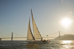
Last night the sea was totally calm and glassy on my watch, no sign of a ripple anywhere. The moon, now 3/4 full was brilliant and the reflection off the water like glistening spotlights. We passed under and around many clouds, some with rain in them, others flashing lightening from time to time - the scene all surreal. But, for Music herself, there was no rain on my watch, and my 3 hours passed quietly, peacefully. With 120NM to go as I write this note at 11:00AM PV time, tonight will be our last night on the water before landfall. ETA is about 8AM tomorrow morning, which will probably be about 5AM local time, so we will most likely have to heave to and wait a bit for daylight, unless we slow our speed to stretch time out. All of this is assuming that we keep motoring to the end.
When it comes to the weather we've encountered between 8N and here, 8S, the grib files have been generally wrong in wind direction and strength. The fist time they matched our visual information was yesterday. The satellite photos have been a real help in at least showing us where the cloud activity, and presumably ITCZ,was. Initially we also relied on the human analysis (NOAA surface analysis) via our weather fax program in Sailmail. Diving south after breaking through the initial ITCZ zone whenever it looked like it (the ITCZ) would potentially materialize in front of us. And, in that respect it seemed the Zone, as we dubbed it was chasing us further and further south.
Yesterday when dawn brought light winds that grew lighter as the day progressed until they died all together, we decided the Zone found us, and we could outrun it no more. Consequently, we tried several times to download surface analysis weather faxes, but we continually had too much interference and they were unreadable. Sometime in the middle of Bob's watch we finally got a readable surface analysis, and guess what? Despite the fact that we'd been motoring in glassy seas, thundershowers at times all around us and no wind, the analysis showed that we were midway between what appears to be a low on the southwest corner of our geographic area of analysis and a high to the southeast of our position with an outer isobar line indicating 1012 millibars. It seems like we should have at least some wind, but siince we were motoring, we obviously had (and still have) nothing of the sort.
The long and short of this is: Collect your weather data from as many sources as seems reasonable for the situation, make your own correlation, and draw your own conclusion based on the information at hand, GRIB, GOES satellite images, and human analysis, and maybe toss a coin to see how it lands. Then sail the weather you've got.
It is one thing aiming for a waypoint on a chart plotter. It is quite another to actually arrive at a tiny island in the middle of nowhere and actually make landfall. So, here, 50 nautical miles from Hiva oa and we can't see the island because it is night time. But I would truly love to see the island on the horizon. Then I could say "Yes, John, you made it and you navigated here yourself. But now I must sleep and leave that to my crew. I only asked Bob two things when he wakes me for my next watch at 6AM PV time. 1: That we not run into the island. 2: That the island be right there.


No comments:
Post a Comment